Madeira Maps and Orientation
(Madeira, Portugal)
The Autonomous Region of Madeira is a significant archipelago and part of Portugal, and comprises two significant populated islands - those of Madeira and Porto Santo. There are also a further couple of island groups within the overall archipelago and they are named the Desertas and the Selvagens.
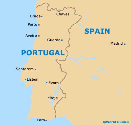
Madeira Island lies within the Atlantic Ocean and a long way from mainland Portugal, lying directly to the south-west of
Lisbon and west of Rabat,
Morocco. In fact, Madeira is such a long way from mainland Portugal, that the Canary Islands of
Spain are actually closer and located to the south.
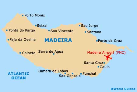
Maps and Orientation of the Island
A reasonably large island with a population of approximately half a million residents, Madeira resides within the African Plate and is actually around 650 km / 403 miles from the coast of North Africa. Funchal is the capital of the Madeira and can be found on the southerly side of the island. Other important municipalities and parishes include:
- Ribeira Brava - west-central
- Machico - north-east
- Camara de Lobos - west-central
- Santa Cruz - east
- Santana - north
Those planning to explore Madeira by car will find that island maps are essential, although most roads are reasonably signposted. The following destinations are shown in relation to Madeira itself:
- Desertas Islands - south-east
- Porto Santo Island - north-east
- Savage Islands - south
- El Hierro (Spain)- south
- Fuerteventura (Spain) - south
- Gran Canaria (Spain) - south
- La Gomera (Spain) - south
- La Palma (Spain) - south
- Lanzarote (Spain) - south
- Tenerife (Spain) - south
Map of Portugal
Map of Madeira